Tahoe Rim Trail by Hauserman Tim;
Author:Hauserman, Tim;
Language: eng
Format: epub
ISBN: 6188798
Publisher: Wilderness Press
Published: 2020-08-15T00:00:00+00:00
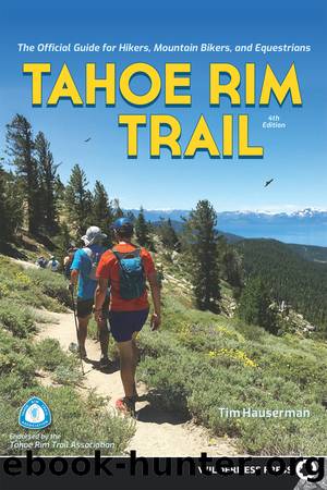
Marlette Lake and Lake Tahoe from the saddle below Snow Valley Peak
After an initial fun ride across the meadow and then along the old Ophir Creek Trail, you turn right and climb to a saddle. Then it is a wonderful, sometimes challenging ride, mostly downhill, for the next 8 miles to Tunnel Creek Road. The trail is sandy and soft in some sections, but in most places it is firm and a real pleasure to ride. Some will feel challenged by portions of the trail; for most, the trouble is well rewarded.
At Tunnel Creek Road you can turn right and ride downhill 3 miles to NV 28, where you can have a car shuttle awaiting you. You could also meet the Tahoe East Shore Trail at the lake. This 3-mile bike trail provides access to Sand Harbor State Park as well as some spectacular swimming beaches along the route.
Or you can cross Tunnel Creek Road and head a short distance to Twin Lakes. The next few miles after Twin Lakes are a challenging, steep uphill ride but worth the effort, as they eventually lead to spectacular views of Marlette Lake and Lake Tahoe. When you reach Hobart Road, turn right. Bikes are not allowed on the rest of this section of the TRT. Hobart Road takes you down to Marlette Lake, where you follow North Canyon Road out to the parking lot at Lake Tahoe Nevada State Park, where fees are required for parking or for riding through the park.
GETTING THERE, NV 431 (MOUNT ROSE HIGHWAY) TO SPOONER SUMMIT The trailhead is 7.3 miles north on NV 431 (toward Reno) from the junction of NV 28 and NV 431 in Incline Village. You will drive past Tahoe Meadows to a parking area and restroom facility on your right. The trail starts from the western edge of the lower parking lot. From Reno, this trailhead is found about 0.75 mile after the highway tops the Mount Rose Summit.
GETTING THERE, SPOONER SUMMIT TO NV 431 (MOUNT ROSE HIGHWAY) From Tahoe City you travel 27 miles east on CA/NV 28 to reach the junction with US 50. Turn left on US 50, and drive 0.7 mile to the trailhead on the north (left) side of the road (approximately 14 miles northeast of South Lake Tahoe on US 50). There is a small paved parking area on the north side of the highway, situated across from a larger paved parking lot, which provides access to the southbound TRT. It is important to realize that Spooner Summit is not the same as Spooner Lake. Spooner Lake is about 0.5 mile west of the junction of US 50 and NV 28 on NV 28. Entrance to the popular Spooner Lake area (with access to the Flume Trail) requires a fee; to reach it, drive 0.6 mile northwest from the junction.
Trail Description
FROM NV 431, known locally as the Mount Rose Highway, the southbound TRT runs parallel to the highway, descends past several streamlets, and then crosses through
Download
This site does not store any files on its server. We only index and link to content provided by other sites. Please contact the content providers to delete copyright contents if any and email us, we'll remove relevant links or contents immediately.
| Bike Repair | Excursion Guides |
| Mountain Biking |
Shoe Dog by Phil Knight(4893)
The Rules Do Not Apply by Ariel Levy(4525)
Walking by Henry David Thoreau(3685)
Running Barefoot by Amy Harmon(3338)
I'll Give You the Sun by Jandy Nelson(3274)
How to Read Water: Clues and Patterns from Puddles to the Sea (Natural Navigation) by Tristan Gooley(3241)
Crazy Is My Superpower by A.J. Mendez Brooks(3205)
How to Read Nature by Tristan Gooley(3080)
How Music Works by David Byrne(2965)
The Boy, the Mole, the Fox and the Horse by Charlie Mackesy(2821)
The Fight by Norman Mailer(2706)
Seducing Cinderella by Gina L. Maxwell(2544)
Cuba by Lonely Planet(2488)
Accepted by Pat Patterson(2219)
Going Long by Editors of Runner's World(2213)
The Unfettered Mind: Writings from a Zen Master to a Master Swordsman by Takuan Soho(2159)
The Happy Runner by David Roche(2122)
Backpacker the Complete Guide to Backpacking by Backpacker Magazine(2111)
Trail Magic by Trevelyan Quest Edwards & Hazel Edwards(2058)
